 |
 |
 |
|
|
|||||||||||||||
|
|
 |
|
|
||||||||||||||||
 |
|
|
|||||||||||||||||
 |
|
||||||||||||||||||
 |
|
||||||||||||||||||
|
|
|
||||||||||||||||||
|
|
|
||||||||||||||||||
|
|
|
|
|||||||||||||||||
|
|
 |
 |
 |
 |
 |
 |
 |
 |
 |
 |
|
|
|||||||
 |
|
||||||||||||||||||
|
|
|
|
|
|
|
|
|
|
|
|
|
|
|
|
|
|
|
|
|
|
| ||||||||||
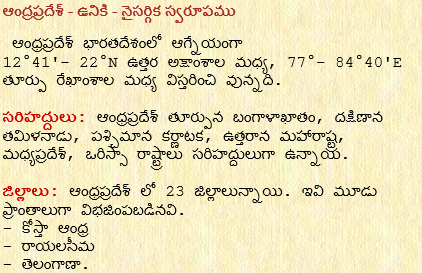
| Andhra Pradesh GeographyAndhra Pradesh lies between 12°41'-22°N latitude and 77°and 84°40'E longitude |
|||||||||
|
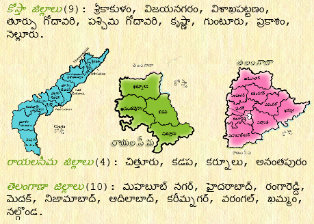
Coastal Districts(9): SriKakulam, Vijayanagaram, Visakhapatnam, East Godavari, West Godavari, Krishna, Guntur, Prakasam, Nellore. Rayalaseema Districta(4): Chittor, Kadapa, Kurnool, Anantapur. Telangaanaa Districts(10): Hyderabad, Mahaboobnagar, Rangareddy, Medak, Nizamabad, Adilabad, Kareemnagar, Warangal, Kammam, Nalgonda. |
|||||||||
| Natural regions: The landscape of Andhra Pradesh is divided into 3 natural regions. They are: - Deccan Plateau - Eastren Ghats - Eastren Coastal Plains |
|||||||||
| Deccan Plateau: This is also called peninsular Plateau region. This region consists of archions, nice, and granite rocks. This region spreads around Rayalaseema, Anantapur, Kurnool districts and the whole of Telangana districts. In Adilabad, Karimnagar, Warangal, Kammam districts and around the banks of Godavari contains the Godvana rocks. These places are the rich in coal. The average height of this Plateau is 400 - 600m. As the Plateau is rich in granite and nice mines it is not very fertile. The rainfall here is around 63-100cm. Temperature is around 35o. Due to these conditions life in this Pateau region is harsh. | |||||||||
| Eastern Ghats: The Eastern Ghats are on the eastern border of the Delta region and stretches from north to south. These are not as distributed in the south and extreme north. The ranges in the north are called Eastern ranges and that in the south are called Kadapa ranges. The average height of the Eastern ranges is 1066m. The highest being 'Mahendragiri' which ranges upto 1524m. The hills near Visakhapatnam that protrudes into the sea like the Dolphin nook, kaina hill, Yarada hill and in the region surrounding river Godavari are the Papi hills, Dhuma hills are also part of Eastern Ghats. In the narrow gorge between the Papi hills the Godavari river flows is a beautiful place. The Kadapa ranges around the Krishna river consists of the 'Nallamala hills', 'Erramala hills', 'Velikonda', 'Palakonda', 'Seshachalam' hills. 'Velukonda' ranges start from the valley of the 'Suvarnamukhi' river and stretches towards north crossing Nellore, Prakasam, Guntur towards the east. The 'Nallamala' ranges are closely connected to the 'Venukonda' ranges in the south. The stretch across Kadapa, Nellore, Kurnool, Mahaboobnagar districts. 'Palakondalu' stretch across Kadapa, Chittor districts. The 'Nandhyala' valley lies between 'Seshachalam' and 'Erramala' ranges. The 'Kadapa' ranges consists of 'Kondapalli' hills in Mogalirajapuram of Krishna district, 'Bellamkonda', 'Gani konda', 'Nagarjuna konda', 'Vinukonda', 'Kondaviti konda', 'Chimakurthi konda', 'Mangalagiri konda' of Guntur district, 'Tirumala' hills, 'Avupalli' and 'Horsley' hillsin Chittor district. The Horsley hills are also called 'Enugumallamma' hills and has a height of 1250m. | |||||||||
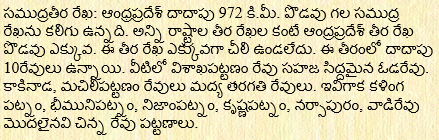
| Eastern Coastal Plain:The plains between the Eastern Ghats and Bay of Bengal coast line consists of the Eastern Coastal Plains. The height is just around 5 to 50m above sea level. This is totally made of the mud that the rivers bring about in their journey. This stretches from 'Mahendragiri' in the North to the 'Pulikat' lake in the south stretching around 950k.m. In the north near Mahendragiri it starts with 19k.m and expands to 160k.m. as it proceeds to the middle. Starting from Vamsadhara river delta and stretching to Godavari and Krishna deltas. It narrows to 22.5k.m, as it reaches Nellore district and ends at the Pulikat lake. The Godavari Delta spreads from Davaleswaram at 70k.m to the seacoast. Krishna Delta starts from Vijayawada to the seacoast and spreads around 70k.m. The slant between the Krishna and Godavari Deltas is lies the 'Kollaru' lake. It has an area of 260sq.k.m The seacoast that stretches for many kilometers consists of forests and sandlots. |
|||||||||
|
| *** | |||||||||
| Back | ||||||||||

|
||||||||||